
Du følger nu
Fejl under følg af bruger.
Denne bruger har ikke tilladt andre bruger at følge dem.
Du følger allerede denne bruger.
Din medlemsskabsplan tillader kun at følge 0. Opgrader her.
Du følger nu ikke længere
Kunne ikke stoppe med at følge bruger.
Du har nu anbefalet
Kunne ikke anbefale bruger.
Noget gik galt. Forny venligst siden og prøv igen.
Email verificeret.

adana,
turkey
Det er i øjeblikket 6:07 AM her
Tilmeldt august 13, 2018
6
Anbefalinger
Murat B.
@muratbayzt
5,4
5,4
100%
100%
adana,
turkey
100 %
Jobs færdiggjort
100 %
Indenfor budgettet
100 %
Til tiden
17 %
Genansættelsesrate
Geomatics Engineer and GIS Analyst
Kontakt Murat B. omkring dit job
Log ind for at diskutere detaljerne via chat.
Portfolio-mappe
Portfolio-mappe


Autodesk Meshmixer 3D Model Editing
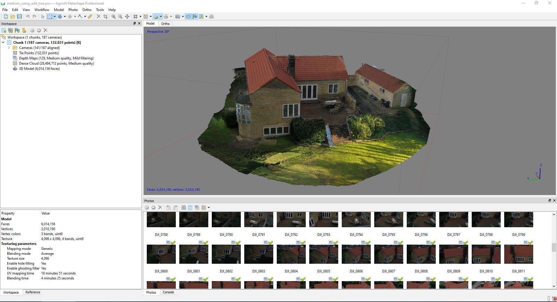

Photogrammetry 3D model with Agisoft Metashape

Photogrammetry 3D model with Agisoft Metashape

Photogrammetry 3D model with Agisoft Metashape

Photogrammetry 3D model with Agisoft Metashape


Network Analysis for finding reachable areas
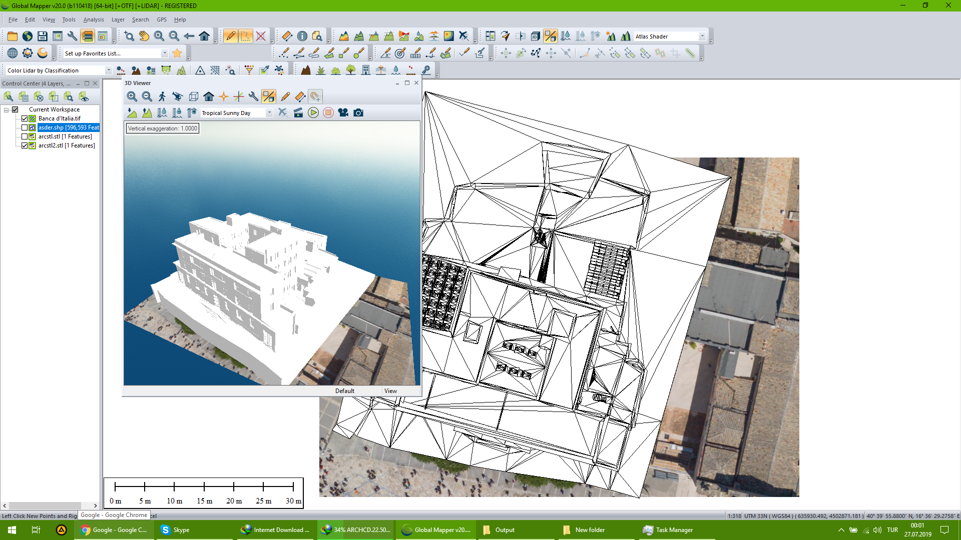

Georeferencing of 2D dwg file and 3D stl file

Georeferencing of 2D dwg file and 3D stl file

Georeferencing of 2D dwg file and 3D stl file


2D floor plan and a section plan of a church room

2D floor plan and a section plan of a church room


Elevations plans

Elevations plans
Autodesk Meshmixer 3D Model Editing
Photogrammetry 3D model with Agisoft Metashape
Photogrammetry 3D model with Agisoft Metashape
Photogrammetry 3D model with Agisoft Metashape
Photogrammetry 3D model with Agisoft Metashape
Network Analysis for finding reachable areas
Georeferencing of 2D dwg file and 3D stl file
Georeferencing of 2D dwg file and 3D stl file
Georeferencing of 2D dwg file and 3D stl file
2D floor plan and a section plan of a church room
2D floor plan and a section plan of a church room
Elevations plans
Elevations plans
Anmeldelser
Ændringer gemt
Viser 1 - 5 ud af 22 anmeldelser
€450,00 EUR
CAD/CAM
Cartography & Maps
Geolocation
3D Modelling
+1 mere
S

•
€530,00 EUR
Google Maps API
Geographical Information System (GIS)
Z

•
$1.700,00 AUD
Geographical Information System (GIS)
Data Analysis
A

•
$70,00 USD
Data Entry
Excel
Geographical Information System (GIS)
S

•
Pris ikke oplyst
J
•
Erfaring
GIS Consultant
jul. 2018 - dec. 2018 (5 måneder, 1 dag)
I have worked in here with Arcgis and Arcserver to make sure to qualify of collected datas from land is good and their relationship between them is problem free. I lead a team that collects data for server. Solving their problems with server. Checking their quality of vectorization works and tabular data accuracy.
Geomatics Engineer
jan. 2018 - sep. 2018 (8 måneder, 1 dag)
I have worked here about Land surveying, Digital Mapping and Expropriation for
Energy Transmission Lines. Maked Preparations for land surveying, flight plans and drone flights for photogrammetric modelling, calculation about how much land needed for a specific
energy transmission line and how much it will cost for its expropriation and what will be offical procedures.
Geomatics Engineer
jul. 2017 - dec. 2017 (5 måneder, 1 dag)
I worked at project about road traffic sheet. Collecting road traffic sheets and editing them with CAD softwares for quantity surveying.
Uddannelse
Bachelor
(4 år)
Kvalifikationer
CAD Education
Netcad
2017
Education about CAD, 3D modelling, Creating 3D lands via collected points from land surveying, photogrammetric surveying or LIDAR data. CAD usage and combining CAD with expropriation for road or energy transmission lines projects.
Arcgis Education
Islem
2017
Its about GIS and how to use Arcgis and its toolboxes.
Map Creator
Here maps
2016
Collecting and editing geographic datas.
Kontakt Murat B. omkring dit job
Log ind for at diskutere detaljerne via chat.
Verifikationer
Certifikationer
Bedste færdigheder
Gennemse lignende fremvisninger
Invitationen blev sendt!
Tak! Vi har sendt dig en e-mail med et link, så du kan modtage din kredit.
Noget gik galt, da vi forsøgte at sende din mail. Prøv venligst igen.
Kopiering til clipboard fejlede. Prøv venligst igen efter justering af dine tilladelser.
Kopieret til udklipsholder.
Indlæser forhåndsvisning
Geolokalisering er tilladt.
Din session er udløbet, og du er blevet logget ud. Log venligst ind igen.